
About the service
At Insignia Infratech, we provide accurate and reliable survey and investigation services to support infrastructure planning, engineering design, and project execution. Using advanced technologies and modern survey techniques, we deliver precise data, technical analysis, and ground investigations essential for successful and efficient project development.
Why choose us
Expert Engineering Team
Experienced professionals delivering innovative and practical infrastructure solutions.
Advanced Design Approach
Use of modern tools for precise planning, structural analysis, and highway design.
Quality & Compliance
Designs aligned with IRC, MoRTH, and international engineering standards.
End-to-End Project Support
From surveys and feasibility to project supervision and management.
Sectors offered
Topographical Survey
Detailed land and terrain mapping to support infrastructure planning, design accuracy, and project execution.
DGPS Survey
High-precision DGPS surveys providing accurate geospatial data for engineering design and construction projects.
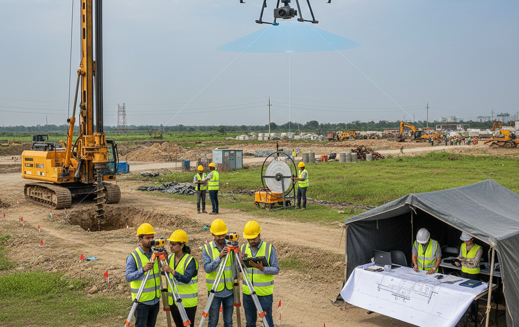
LiDAR Survey
Advanced LiDAR-based surveys for high-resolution terrain modelling and large-scale infrastructure planning.
Aerial Survey
Drone and aerial survey solutions delivering fast, accurate site mapping and visual project data collection.
Geotechnical Investigation
Comprehensive soil testing and ground investigations to evaluate foundation conditions and structural feasibility.
Ground Penetrating Radar (GPR) Survey
Non-destructive subsurface investigations using GPR technology to detect underground utilities and structures.
Site Inventory Surveys
Detailed site assessments and inventory documentation to support planning, approvals, and infrastructure analysis.
Quantity Surveying & Cost Estimation
Accurate quantity take-offs and cost estimation services to support budgeting, tendering, and financial planning.